
Separated from the capital city by 46 km, the province’s largest region lies to the south of the Guadalquivir.
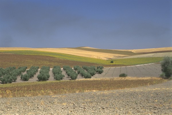
The Campiña is a peneplain that stretches from the valle del Guadalquivir [Guadalquivir Valley] to the Sierras Subbéticas. This terrain, characterised by gentle slopes, covers an area of approximately 1097 km2 and lies at an altitude of 300 metres above sea level.
The region has a population of around 102,805 inhabitants, distributed amongst 11 municipalities: Aguilar de la Frontera, Fernán Núñez, Montilla, Moriles, Montalbán, Monturque, Montemayor, La Rambla, Puente Genil, San Sebastián de los Ballesteros and Santaella.
The Campiña is divided into three distinct areas: the eastern area, known as the Campiña Baja, produces olives and cereals and stretches between the Guadalquivir and it tributary, the Guadajoz; the Campiña Alta, the central area, which includes vineyards, extends between the Guadajoz and the Genil, whilst to the west, we encounter the area known as Las Colonias, which contains the towns and villages founded in the 17th century by Charles III.
Scattered throughout the entire Campiña, we come across centres of industry and craftwork, with particular stress on food and agricultural products, ceramics, bronze, copper, brass and furniture. Within the food and agricultural sector, attention should be drawn to the quince jelly industry in Puente Genil and the production of acclaimed wines bearing the Montilla-Moriles guarantee of origin and quality.
The Campiña extends between the valle del Guadalquivir [Guadalquivir Valley] to the Sierras Subbéticas, in the south of the province of Córdoba. This terrain was formed in the Miocene and the Quaternary era, giving rise to gently sloping hills punctuated by higher elevations that are the seat of fortified towns and villages dating from the Medieval period.
The central and largest area of the region dates from the Miocene and is composed of deep-lying fertile, clayey soil known as the mudlands or black Andalusian terrain.
To the northeast, in the area occupied by the towns and villages founded by Charles III, we find the Villafranchian glacis, made up of stony reddish earth, whilst to the southeast, the meridional periphery of the Campiña, presenting a more rugged relief and poorer soils, marks the transition to the Sierras Subbéticas.
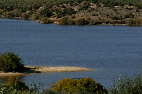
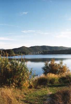
In terms of environmental resources, attention should be drawn to the so-called Zonas Húmedas [wetlands] in the south, which include the following: the Laguna de Zóñar [lake] and the Rincón in Aguilar, the Laguna de Tíscar [lake] and the Cordobilla reservoir in Puente Genil and the Laguna del Donadío [lake] within the municipal limits of Santaella. All of these places provide nesting areas and refuge for aquatic birds such as white-headed ducks, cattle egrets, herons and cormorants.
The rivers of the Campiña, the Guadajoz in the northeast and the Genil in the southeast, follow an almost parallel course in a southeast/northwest direction, before flowing into the Guadalquivir.
The main roads within the region also run parallel and in a similar direction: the N-331 in the west, in the area of the Campiña given over to wine production, and the C-432 in the east, in the area of the Campiña given over to the production of olives and cereals.