
The River Guadiato and its valley are used to designate a large area of the Province of Córdoba that presents beautiful landscapes and an alluring ecosystem for nature lovers.
Located in the northwest of the province and covering an area of 2512 km2, the region takes in 11 municipalities: Bélmez, Los Blázquez, Espiel, Fuente Obejuna, La Granjuela, Obejo, Peñarroya-Pueblonuevo, Valsequillo, Villaharta, Villanueva del Rey and Villaviciosa de Córdoba.
Nowadays, an excellent road network ensures that all of these towns and villages are easily accessed from the Castilian meseta, Extremadura and the rest of Andalusia.
The Valle del Guadiato [Guadiato Valley] region possesses a series of characteristics that enable it to cater to visitors who wish to enjoy tranquillity and a peaceful atmosphere, incomparable landscapes, rich flora and fauna, hunting or an important historical heritage. The region possesses reservoirs, a pleasant climate, a wealth of natural beauty spots, picturesque villages and a rich gastronomy, wherein dishes prepared with game meat and Iberian pork come to the fore. Hiking, bicycle routes, water sports and hunting are but a few of the multiple offers that are available in the Valle del Guadiato region, without the need of going further afield.
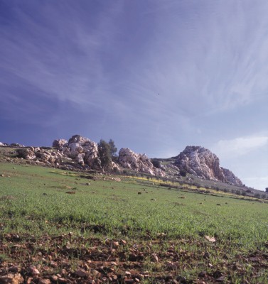
The cordovan section of the Sierra Morena, the central area of this range, dominates the landscape in south, taking its name from the dark layer of vegetation in which it is covered. A belt of folded material, known by geographers as the “carboniferous syncline of the Guadiato”, cuts through the region in a northwest/southeast direction, bordered by Los Pedroches and the Sierra de los Santos.
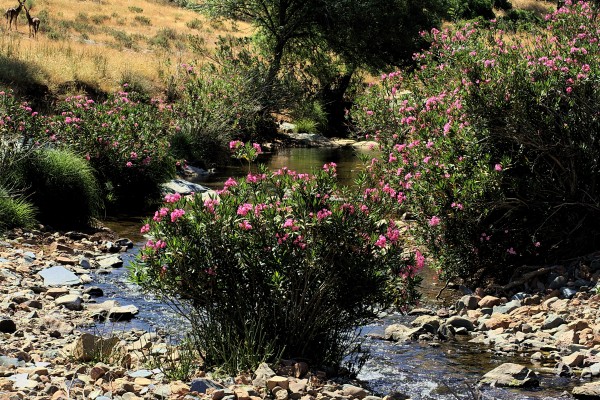
The belt coincides with the valley of the Guadiato, the main river in the region, which has its source in Fuente Obejuna and descends parallel to the mountains until it reaches Villaviciosa, where it turns to the east to join with the Guadalquivir just past Almodóvar.
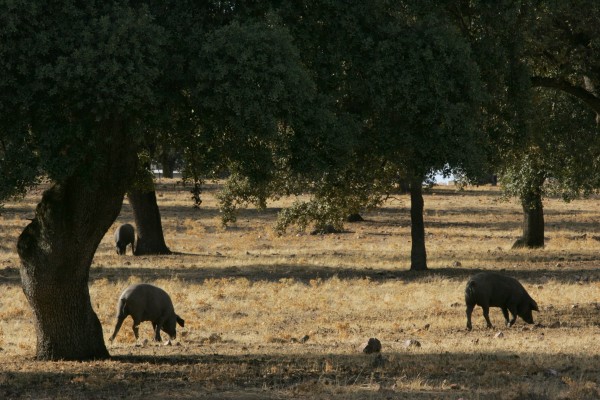
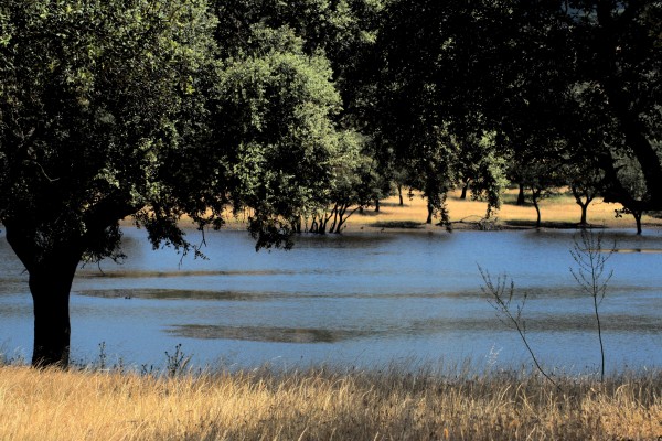
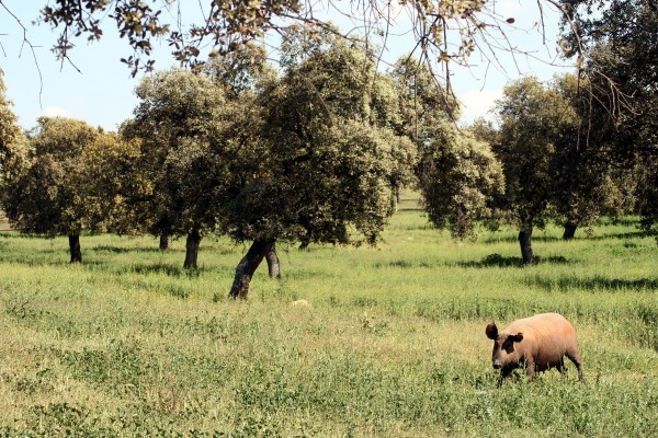
During its descent, it receives numerous tributaries, which, in general, are short, narrow streams running down steep inclines. Whilst pine-based reforestation has altered the autochthonous plant life in certain areas, numerous pockets of Mediterranean forest remain, particularly in the south, which are populated with ilexes, cork oaks, gall oaks and thickets. Moreover, the banks of some rivers and streams boast well-conserved gallery forests. The Puente Nuevo and Sierra Boyera reservoirs, especially over the winter months, attract various species of aquatic birds, such as mallards, coots, cinnamon teals and cormorants. Birds of prey circle over crags, whilst hillside hunting grounds are home to deer and wild boars.
The discovery of coalfields in 1778 represented the beginning of an era of prosperity for the area, particularly from the second half of the 19th century onwards, when overseas concessionaires set up in the region.
The French Mining and Metallurgical Company in Peñarroya was the most important corporation of this nature, although it abandoned the area in the wake of the coalmining crisis and was substituted by Encasur, a public sector company, in 1961. The decline of the mining sector inevitably affected the industry centred in Peñarroya-Pueblonuevo, which in the 1940’s reached a population total of 30,000 inhabitants.
The energy crisis arrested the fall in the price of coal, and open-pit mining, which has a devastating effect on the landscape, gradually replaced traditional techniques. The extracted mineral is burned in power stations, such as the station in Puente Nuevo, in order to generate electricity.
Agriculture in the region involv! es the cultivation of olives, extensive cereal farming, pastures populated with ilexes, to provide food for pigs and sheep, and isolated pockets of riverside crops.